SHIRA ROUTE
Climbing Mount Kilimanjaro on the Shira Route
Climbing Kilimanjaro via the Shira Route requires both time and financial investment. The Shira trail, along with the Lemosho Route, starts on the western side of the mountain and crosses the Shira Plateau before joining the Machame Route near the Lava Tower.
Choosing the Shira Route is not the most budget-friendly option due to several factors:
- Starting on the western side requires additional transport costs.
- Using a longer trail means an extra day on the mountain.
- Less traffic on this route results in higher prices due to limited competition from budget tour operators.
However, the benefits of this route are significant. A longer trail allows for better acclimatization and, therefore, higher chances of reaching the summit. Additionally, climbing with a quality Kilimanjaro tour operator improves your success rate.
If your operator carefully plans the itinerary to avoid the traffic surges on the Machame trail, you can enjoy a scenic climb without the crowds that affect the more popular routes.
A unique feature of the Shira Route is that the initial section is a 4WD track, allowing for a higher starting point. This can be a disadvantage if you live at sea level and attempt a quick climb, as rapid elevation to above 3500 m (11,500 ft) might lead to altitude sickness. For most, acclimatization isn’t an issue if you’ve spent a few days in Marangu or have done prior trekking, such as climbing Mt. Meru.
It’s important to consider acclimatization, especially if you plan to minimize time and costs by squeezing the climb into a week. The following itinerary assumes a slower pace with a full walk from the start.
Below are detailed notes on what to expect during a Kilimanjaro climb on the Shira Route.
One unique aspect of the Shira Route that sets it apart from all other Kilimanjaro climb routes is that its first section follows a 4WD track. This allows climbers to drive up a significant distance, starting the trek at a higher altitude.
If you live at sea level and are trying to fit a Kilimanjaro climb into a one-week vacation, this rapid ascent could be problematic. Although the Shira Route offers ample time for acclimatization later on, some climbers might experience altitude sickness at these initial elevations. Jumping from sea level to over 3500 m (11,500 ft) shortly after arriving in Tanzania may not be the wisest choice.
For most climbers, this isn’t an issue. Spending a day or two in Marangu or undertaking some preliminary trekking and acclimatization (such as climbing Mt. Meru) can mitigate the risks associated with this quick ascent.
It’s important to highlight this because many climbers attempt to fit the climb into a short time frame and minimize costs, such as skipping an extra night in Marangu or Moshi. The itinerary provided below follows a slower pace, involving walking the entire distance from the start.
Here are some detailed notes on what to expect during a Kilimanjaro climb on the Shira Route.
Shira Route Itinerary
There are many possible slight variations to the Shira Route, so don’t be surprised if you see an itinerary that mentions different camps and altitudes. In fact, many agencies refer to the Lemosho Route as the Shira Route, because it also crosses the Shira Plateau.
The itinerary below describes a six-night/seven-day Kilimanjaro climb on the Shira Route.
Similar to the Machame Route, this trek can be shortened by skipping the night in the Karanga Valley and walking straight from the Barranco Huts to the Barafu Huts in one day. It can be shortened further by driving instead of walking on the first day and skipping the first camp.
The trek can be extended by adding an extra night at Moir Huts for acclimatization.
For experienced mountaineers, there is also a challenging and dangerous specialist version via the Western Breach.
(Note: altitudes and distances are approximations. Different sources may give you varying numbers.)
Starting Point: Londorossi Gate (2100 m/6900 ft)
Duration: 6-7 days
Day 1 – Londorossi Gate/Shira Trail Head – River Camp (~3050 m/~10000 ft)
- Walking distance: 7 km/4.4 miles
- Walking time: 4 hours
- Altitude gain: ~950 m/~3100 ft
Day 2 – River Camp – Shira Huts (3850 m/12630 ft) via Shira Cathedral
- Walking distance: 12 km/7.5 miles
- Walking time: 6-8 hours
- Altitude gain: 800 m/2630 ft
Day 3 – Shira Huts – via Lava Tower (4640 m/15220 ft) – Barranco Huts (3985 m/13070 ft)
- Walking distance: 9 km/5.6 miles
- Walking time: 6-8 hours
- Altitude gain: 135 m/440 ft (790 m/2590 ft to Lava Tower)
Day 4 – Barranco Huts – Karanga Camp (4040 m/13255 ft)
- Walking distance: 5.5 km/3.5 miles
- Walking time: 4-5 hours
- Altitude gain: 55 m/185 ft
Day 5 – Karanga Camp – Barafu Huts (4680 m/15360 ft)
- Walking distance: 3.5 km/2.2 miles
- Walking time: 4-5 hours
- Altitude gain: 640 m/2105 ft
Day 6 – Summit attempt via Stella Point (5752 m/18871 ft) to Uhuru Peak (5895 m/19340 ft) and descent to Millennium Camp (3820 m/12530 ft) (or to Mweka Hut)
- Walking distance: 5 km/3 miles ascent + 10 km/6.2 miles descent
- Walking time: 5-6 hours up + 1-2 hours up, 5-6 hours down (the overall walking time may vary from 10 – 16 hours)
- Altitude gain: 1072 m/3511 ft (Stella Point) or 1215 m/3980 ft (Uhuru Peak)
- Descent: 2075 m/6810 ft
Day 7 – Millennium Camp – Shira Gate
- Walking distance: 20 km/12.5 miles
- Walking time: 5 hours
- Descent: 1990 m/6530 ft
Climbing Mt. Kilimanjaro – Shira Route – Day 1
The starting point for the Shira Route is the Londorossi Gate, which is also used for the Lemosho Route. It takes a two to three hour drive to reach the gate, and on this first day, you might spend more time driving and waiting around at the gate than actually walking.
Londorossi, both a village and a park gate, has a rustic, wooden appearance reminiscent of an old Western movie. The high timber fences are designed to keep wildlife out.
Choosing these less trafficked routes, such as Shira and Lemosho, offers a better chance to see wildlife in the early days, with Lemosho being slightly more favorable for wildlife spotting. However, everyone has a good chance of seeing the beautiful black and white Colobus monkeys, as they are often found in the trees near the park ranger quarters. You can observe them while waiting for your registration and permits – the usual start of a Kilimanjaro climb!
After completing the registration, what follows is unique: you continue driving. The Shira Route is the only Kilimanjaro climb route that allows driving for a portion of the first day. In theory, you could drive all the way to the Morum Barrier at the foot of Morum Hill, though only emergency vehicles are allowed beyond this point. This bypasses the first camp and brings you to an altitude of about 3500 m (11500 ft).
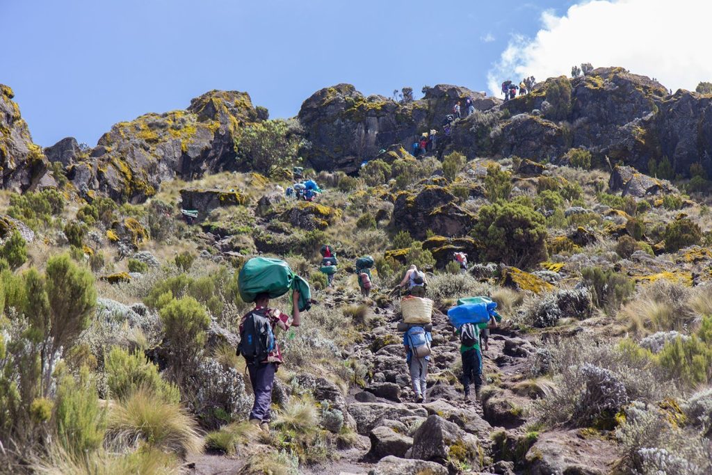
Alternatively, you can walk, following the same road. Although walking on a 4WD track might not be as appealing as a narrow wilderness trail, the rainforest here is at least as beautiful as along the Machame and Marangu routes, if not more so. (And the chances of rain are just as high, if not higher.)
The birdlife is excellent, and you might see more Colobus monkeys. Some very fortunate hikers might even spot elephants or buffaloes (though this is rare).
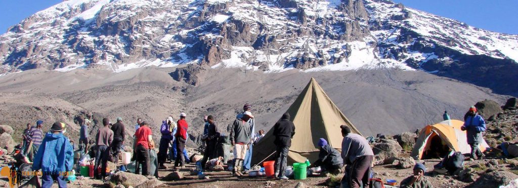
As you follow the Ngarenairobi River, you leave the forest and enter the next vegetation zone: moorland and heather. Your first campsite is situated between the road and the river.
If you choose to walk, the first day can take up to six hours (with breaks), or much less, depending on where you start walking.
Climbing Mt. Kilimanjaro – Shira Route – Day 2
The next day on the Shira Route starts with a gradual ascent towards Morum Hill and Morum Barrier, marking the beginning of the Shira Plateau where half of the climbers commence their Shira trek. Beyond the gate, the road continues but only emergency vehicles are permitted.
From here, you head southeast along a mostly flat path across the plateau. After about two hours, you reach the junction where the Shira Route intersects with the Lemosho Route, near the Simba Cave Campsite at 3590 m (11780 ft), situated alongside the Simba River. Shortly after passing the turnoff to Fischer Campsite at 3885 m (12745 ft), which is off the main trail, you continue for another half hour or so to reach your camp for the night, the Shira Huts. (Despite its name, it’s simply another campsite.)
Alternatively, there’s an option for a detour via the Shira Cathedral, including a climb to its summit at 3720 m (12200 ft). This area features towering rock buttresses surrounded by steep needles and pinnacles, offering a truly scenic and wild experience that’s well worth the extra effort.
For those who opt not to take the detour, the campsite still offers splendid views of landmarks like Shira Needle, Cathedral, and Shira Hill, as well as vistas of Kibo itself and the Western Breach.
Climbing Mt. Kilimanjaro – Shira Route – Day 3
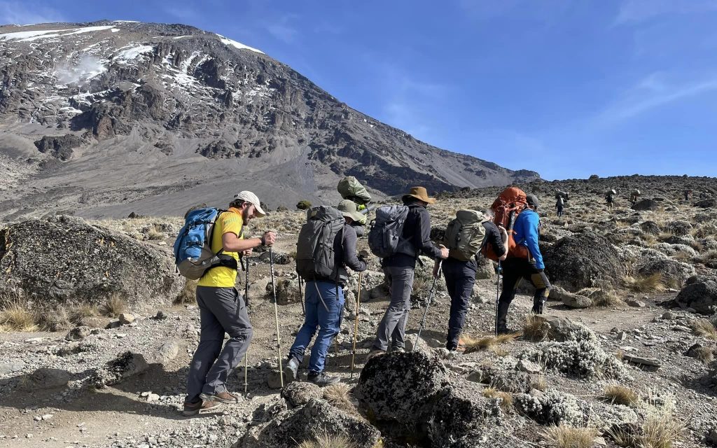
Day three on the Shira Route offers a variety of options, beginning with a steady uphill trek lasting about two and a half hours. As you ascend the slopes of the Shira Plateau, you gradually leave behind the heather and moorland, entering the barren alpine desert region where breathtaking views abound.
Early on, you’ll encounter a junction where you have several choices. One option is to take an acclimatization day by heading towards Moir Huts at 4140 m (13579 ft), a peaceful camp nestled in a valley surrounded by steep slopes. If you opt for this route, you can arrive around midday and spend the afternoon exploring the Lent Hills, including an acclimatization walk up to 4700 m.
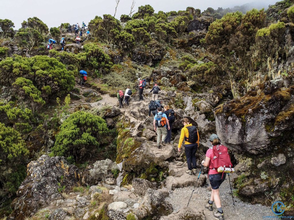
Alternatively, continuing on the main trail, you’ll encounter bends, ups, and downs before reaching the junction with the busy Machame Route. Shortly after, another junction offers the choice to detour towards the Lava Tower or spend an additional night en route. Climbers heading for the challenging Western Breach route will veer towards Lava Tower Camp.
The Lava Tower itself is a volcanic plug rising 100 m (300 ft) above the ground, a remnant of Kilimanjaro’s volcanic past. The path to the tower is a gradual slope, where even the short heather gives way to rocky lava ridges. The climb can be strenuous due to the altitude, with the peak elevation exceeding 4500 m.
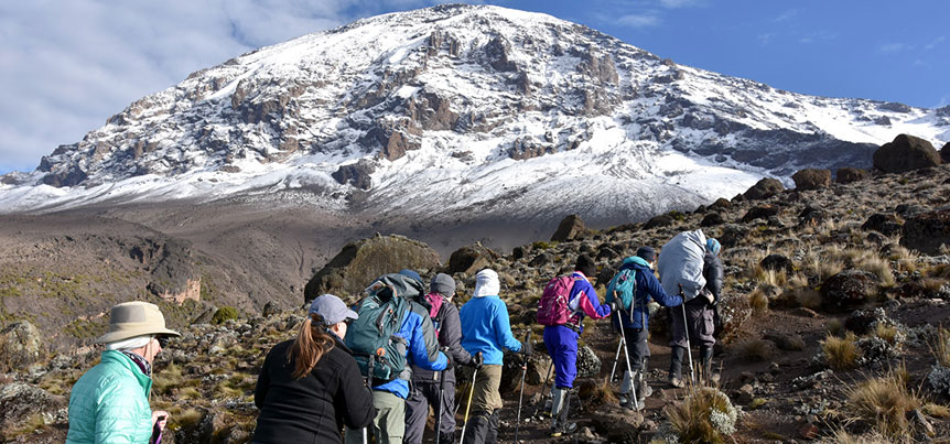
After a well-deserved lunch break near Lava Tower, you descend into the stunning Barranco Valley, formed by a massive landslide millennia ago. Sheltered by towering cliffs, the valley boasts lush vegetation including giant senecios and lobelias. From here, you’ll catch your first glimpse of the Barranco Wall, which you’ll ascend the following day.
Barranco Camp awaits at the end of this demanding day, offering spectacular views of Kibo, the Western Breach, and the southern glaciers. Despite the altitude gained, it’s normal to experience mild symptoms of altitude sickness, but climbing high and sleeping low aids acclimatization.
From Barranco Camp onward, all climbers converge onto the same trail, whether they arrived via Shira, Lemosho, Machame, or another variant like the northern circuit route. It’s a pivotal point on the journey towards Kilimanjaro’s summit.
For further details on this leg of the Shira, Lemosho, and Machame routes, you can refer to a detailed description here.